
The system is very likely to move west-northwestwards and cross north Tamil Nadu and adjoining south Andhra Pradesh coasts around Chennai by the early morning of November 19, 2021.

As per the latest forecast of the Bhubaneswar centre of the India Meteorological Department (IMD), the low pressure area over Southeast Bay of Bengal (BoB) and adjoining North Andaman sea now lies over Southeast Bay of Bengal.

As per IMD, the system is likely to continue to move nearly westwards and reach westcentral and adjoining southwest Bay of Bengal off south Andhra Pradesh- north Tamil Nadu coasts on November 18, 2021.

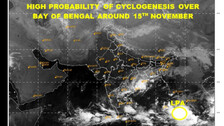
The Low Pressure Area over central parts of Andaman Sea is likely to move west-northwestwards and become well-marked over north Andaman Sea and adjoining southeast Bay of Bengal by 15th November.

Odisha Weather Update: Depression Likely, Rainfall Expected To Increase, Says IMD

As per IMD, the system is likely to move west-northwest wards and concentrate into a Depression over north Andaman sea and adjoining southeast Bay of Bengal by November 15.

A cyclonic circulation currently lies over Gulf of Thailand and neighbourhood and is likely to emerge into South Andaman Sea. Under its influence a fresh low pressure area is likely to form over south Andaman Sea and neighbourhood by 13th November. This information was shared by Bhubaneswar centre of the India Meteorological Department (IMD).

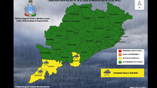
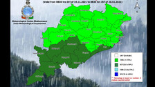
Odisha is likely to experience light to moderate rainfall in many districts till November 16 under the influence of another low pressure this weekend.

Some districts of Odisha are likely to witness light to moderate rainfall owing up to a low pressure area formed over Southeast Bay of Bengal.

The Met department predicts that the system is likely to concentrate into a depression over southwest and adjoining southeast Bay of Bengal during the next 36 hours.

A Low Pressure is likely to form over Southeast Bay of Bengal around November 10, informed the Bhubaneswar Centre of India Meteorological department on Monday.

Fresh low pressure over Bay Of Bengal: IMD DG Mrutyunjay Mohapatra on rainfall and wind speed.

A low pressure area is likely to form over Bay of Bengal. This information was shared by the India Meteorological Department on Friday (November 5).

As per the IMD, light to moderate rainfall is likely to occur in south Coastal Odisha next week due to the low-pressure system.

The Bhubaneswar centre of the India Meteorological Department (IMD) in its latest forecast stated that the trough in easterlies from the cyclonic circulation associated with the Low Pressure Area over Southwest Bay of Bengal has become less marked.

Copyright © 2024 - Odisha Television Limited All Rights Reserved.