
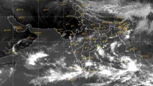
Even as some weather scientists have indicated the intensification of the system into a cyclone, the premier weather agency of the nation-India Meteorological Department (IMD) is still silent on this.
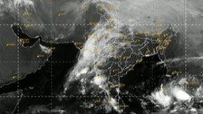
The low-pressure system formed over the Central Andaman Sea has been active and will intensify into Depression by tomorrow while moving in the West-Southwest direction, informed the Bhubaneswar Centre of the India Meteorological Department (IMD).

In the latest advisory issued in the backdrop of IMD’s forecast for heavy rainfall, the SRC office has asked the district Collectors to monitor the situation closely.

As per 3 lead Met model forecasts, 2 LPS to form in Bay of Bengal between Oct 6-12. While one is predicted to see cyclone genesis in Arabian Sea, the other may aim at Andhra Pradesh or Odisha

The forecast shows a deep depression skirting north Odisha, but crossing the West Bengal coasts on Sept 29 to reach Jharkhand. Around October 24, model forecasts predict the formation of some weather disturbances in the northeast Andaman seas

September dropped some big hints about how October is going to be in Odisha. All eyes are on the west Pacific ocean

The sea conditions reveal that while the SST will hover over 30 deg C, the VWS will remain moderate in the range of 10-12.5 knots

It is believed that when the holy flag or the Patitapabana Bana of Sri Jagannath Temple in Puri is white, it is an indication of heavy rain.

Dhamra, the likely landfall place of Cyclone Yaas, is experiencing scattered rainfall since yesterday and wind speed is gradually increasing.

The sea is slowly turning rough as the time for Cyclone Yaas landfall approaches. Water level is rising at Udaipur beach causing panic among locals.

The severe cyclonic storm ‘Yaas’ over Bay of Bengal is set to intensify into a ‘very severe cyclonic storm’ by the evening of May 25th.

Cyclonic storm Yaas is likely to make landfall near Balasore.

A cyclonic storm is very likely to develop between by May 26th over Bay of Bengal. According to the India Meteorological Department (IMD), a low pressure area is likely to form over North Andaman Sea and adjoining East Central Bay of Bengal around May 22.

Bhubaneswar: Summer rains, not the cyclone triggered rain, will lash Odisha till May 5. The probable cyclone taking a hit at Odisha on May 4-5 ebbs further. But post May 5, heat wave will return to the State with a bang. After prediction by Government of India’s top monsoon research unit, the Indian Institute of […]
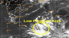
Bhubaneswar: Already grappling with the COVID menace imported from overseas, the country is keenly watching at the development of another danger brewing in the seas this time. And which coincidentally shares the same initial ‘C’ – the ‘Cyclone’ in the Andaman seas. This cyclone seems not in a hurry. Many international Met models predict it […]

Copyright © 2024 - Odisha Television Limited All Rights Reserved.