
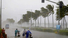
The India Meteorological Department (IMD) has strongly confirmed the probability of the formation of a cyclone over the Bay of Bengal after October 22. But have you ever wondered how are cyclones named and why. Read on to find out.

The research team observed that the loss in functionality of transmission towers depends considerably on the location of the landfall of the cyclone. The damage is greater if the landfall is close to a region with many substations in the vicinity.

Cyclones & Odisha: List Of Cyclones That Hit The State

Some fishermen reported to be residents from Chikiti area of Ganjam district were returning from Vishakhapatnam to Ganjam on a boat. However due to some technical glitches in the boat, they were left stuck in the sea around 1 km from the coast near Sonepur in Ganjam, Jena told reporters.
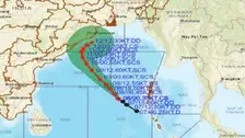
Even though Cyclonic storm Asani is unlikely to make landfall in Odisha coast, it will mostly trigger heavy rainfall in several districts of the State while brushing along the coastline of Odisha on May 10.

The deep depression, which is currently lying at 1100 km south-southeast of Puri over the Bay of Bengal, has turned into a cyclonic storm today, informed India Meteorological Department (IMD) on Sunday.
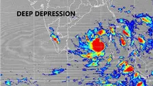
The Depression over Southeast Bay of Bengal has intensified into a Deep Depression, the India Meteorological Department said in a bulletin on Saturday.

The low pressure has concentrated into a well-marked low pressure and it is likely to move northwestward and intensify into a depression over southeast Bay of Bengal during next six hours and further into a cyclonic storm by May 8.
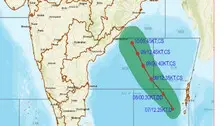
As Odisha braces up for another cyclone developing in the Bay as a low pressure, the State government on Friday put its action plan on place for deployment of response teams in regions most likely to be affected by the probable disaster.

The India Meteorological Department (IMD) on Friday issued heavy rainfall warning for four districts of Odisha on May 10 during the approach of the possible cyclonic system from the Bay of Bengal towards the north Andhra and Odisha coasts.

The Bhubaneswar Meteorological Centre on Friday confirmed that the low pressure area formed over the South Andaman sea on Friday morning may intensify into a depression on May 7 and subsequently turn into a cyclonic storm by the evening of May 8.
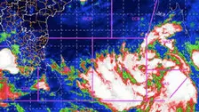
A low pressure area has been formed over the South Andaman sea on Friday morning which may intensify into a cyclone, informed the Meteorological Centre in Bhubaneswar.

As the coastal Odisha braces for another possible cyclone in May, the Special Relief Commissioner (SRC), Pradeep Jena has said that the State government is ready to face any eventuality with 17 NDRF teams, 20 ODRAF teams and 175 fire fighting teams who are on standby.

The letter has been written to Collectors of Ganjam, Puri, Khordha, Jagatsinghpur, Kendrapara,Jajpur, Bhadrak, Balasore, Nayagarh, Cuttack, Mayurbhanj, Keonjhar, Dhenkanal, Malkangiri, Koraput, Rayagada and Kandhamal districts

Cyclone Jawad: IMD briefs media on effect of new moon & high tides during cyclone approach

Copyright © 2024 - Odisha Television Limited All Rights Reserved.