

Scores of farmers of Padampur united under the Krushak Sangathan claimed that their crops were damaged by the Michaung cyclone in December 2023.

The cyclone, packing winds of up to 200 mph, brought destructive winds and a devastating storm surge particularly in Bangladesh's southeastern Cox's Bazar district and its offshore island on Sunday.

The powerful made landfall shortly after midday on the Teknaf shorelines before making its way through the Naf River that divides Bangladesh and Myanmar.
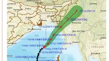
The maximum sustained wind speed during this period will be around 180-190 kmph gusting to 210 kmph.
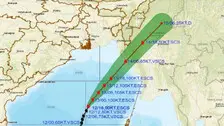
The India Meteorological Department (IMD) on Saturday informed that the system is very likely to move north-northeastwards and intensify further over Eastcentral Bay of Bengal.
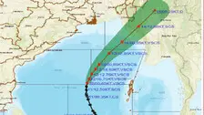
As per IMD, Cyclone Mocha is very likely to move north-northeastwards and intensify further over Eastcentral Bay of Bengal.
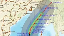
The cyclonic storm is most likely to touch the coast between Bangladesh and Myanmar on May 14th morning.

The deep depression over the Southeast Bay of Bengal has intensified into a cyclonic storm, informed the India Meteorological Department (IMD) regional centre in Bhubaneswar on Thursday.

According to Mohapatra, the depression over southeast Bay of Bengal moved west-northwestwards and has intensified into a Deep Depression.
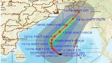
As per IMD, the system is very likely to move northwestwards for some time and then north-northwestwards and intensify gradually into a cyclonic storm over the same region around today evening.

According to information shared by the weather bureau, after intensifying into a cyclonic storm the system will cross south east Bangladesh and north Myanmar coast around forenoon of May 14.
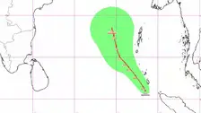
IMD Director General Mrutyunjay Mohapatra said that as far as the forecast for the next five days is concerned, no warning has been issued for several eastern states like Odisha, West Bengal and Andhra Pradesh as of now.

As per IMD Director General Mrutyunjay Mohapatra, a low pressure area has formed under the influence of cyclonic circulation. It is expected to become a depression by tomorrow while moving in north-northwest wards.
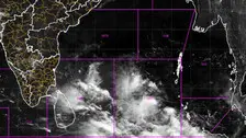
As per the previous forecast, the low pressure system is likely to concentrate into a depression by tomorrow. Similarly, there is every possibility that the system is likely to further intensify into a cyclonic storm.

As per IMD, a cyclonic circulation is likely to develop over Southeast Bay of Bengal tomorrow. Under its influence, a low pressure area is likely to form over the same region around May 7.

Copyright © 2024 - Odisha Television Limited All Rights Reserved.