Twitter
 Telegram
 Google News
Cyclone May Change Path, Maximum Wind Speed To Be Around 100 Kmph: IMD DG
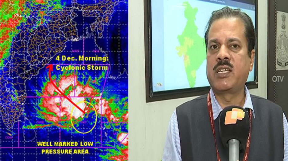
The India Meteorological Department (IMD) is closely tracking the developments related to the formation of a cyclone in the Bay of Bengal. As per IMD, the cyclonic storm is likely to cross Odisha-north Andhra Pradesh coast around December 4 morning. The exact landfall location is yet to be ascertained by the IMD.
Director General (DG) IMD, Mrutyunjay Mohapatra on Thursday said that the current low pressure has become well marked. It is likely to move west-northwestwards and concentrate into a Depression over southeast Bay during next 12 hours. It will further intensify into a Cyclonic Storm over central Bay during subsequent 24 hours.
“The maximum intensity (wind speed) will be around 90 kmph gusting upto 100 kmph. Odisha coast will experience 40 to 50 kmph wind from December 3 and the intensity will increase to 70 to 80 kmph, gusting to 90 kmph on December 4,” said Mohapatra.
Mohapatra further said cyclonic storm is likely to change path. “But whether it will cross the coast, or not, will be ascertained only after the formation of Depression,” he said.
Even though the cyclonic storm is likely to change course, several parts of Odisha will continue to experience rainfall activities. Earlier, the IMD had predicted that rainfall activities will begin in several parts of Odisha from December 3 and heavy rainfall forecast has been issued for December 4.